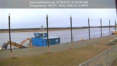
Bethel River Cam
Thank You Sponsors!
-
Most Read
- Weather Cams posted on November 23, 2014
- Success on Day 42 – Kuskokwak Search posted on January 21, 2015
- About BSAR posted on November 19, 2014
NOAA Weather
Bethel, AK
Last Updated on Apr 18 2024, 10:53 pm AKDT
Weather by NOAA
Current Conditions: Overcast
Temp: 37°F
Wind: NE at 10mph
Humidity: 86%
Windchill: 30°F
Weather Forecast
The location could not be found.Post History…
April 2024 M T W T F S S 1 2 3 4 5 6 7 8 9 10 11 12 13 14 15 16 17 18 19 20 21 22 23 24 25 26 27 28 29 30 Visit BSAR YouTube Channel!
Get Updates Automatically!
Bethel Search and Rescue
Welcome to our Website!
Bethel Search & Rescue (BSAR) is located in Bethel, Alaska.
BSAR conducts search and rescue missions in Bethel and the surrounding villages in coordination with the Alaska State Troopers, Bethel Police, Village Public Safety Officers, and other SAR teams from area villages.To report a missing person in the Bethel region, call 911 or (907)545-HELP.
File a Trip Plan BEFORE You Go!
Support…
Bethel Search and Rescue is a 501(c)(3) non-profit that operates on the support of the people and organizations in the Yukon-Kuskokwim Delta region and beyond. By supporting BSAR, supporters become partners in SAR missions. Each supporter should know that when a SAR mission is completed or successful, they have made it possible to find lost victims. Many thanks to all of our supporters, both individuals and businesses.
Contact Us:
Bethel Search and Rescue
P.O. Box 2633
Bethel, AK 99559Hosted By
Admin Users
April 9 ice measurements:
Aniak – 42” middle of main channel just above town. 2” slushy fresh snow cover, first 12” are layers of frozen overflow from the various warm spells over the winter.
Napaimute – 35” mid channel. 2” slushy fresh snow cover. A long swift lead has opened up in the north channel just above Napaimute. You could watch it eating its way down stream. Just before sundown all of the fresh snow melting and running off must have caught up to the River. The water in the open lead began rising up over and flooding the top of the ice. We watched it growing throughout the night and had to warn some late night travelers away from the deepening water. See pictures.
Today a BSAR team went down and drilled the ice at the lower end of the November jam 11 miles below Lower Kalskag. We drilled at the narrowest point in the River below Coffee’s. This is where the November jam first began forming.
The ice in this spot was 58” thick. We couldn’t get through with an extension on the auger and ice picked the rest of the way. There is a layer of very dirty water about halfway through the ice in this area. Also the ice is full of sand, rocks, and sticks.
We’ve been wondering what’s going to happen if the interior temps keep warming up while it looks like the lower River weather is going to stay cool. There was a big difference in the weather today between Napaimute (warm & sunny) and Kalskag (cool & cloudy).
This area may be a place to watch closely this spring
Maybe good thing there’s not much snow.
Additional reports will be provided as the 2015 Kuskokwim Spring Break Up progresses.
Thank you.
Bookmark the permalink.


