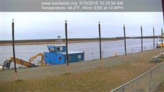
With cooler temperatures and fresh snow People are getting anxious to get started on their usual winter activities.
A BSAR team did an initial assessment of ice conditions in the immediate Bethel area today.
The area assessed was from the upper end of Oscarville Slough to the lower end of Church Slough. This is what they observed:
Ice thickness
Mid Channel straight out from the upper end of Oscarville Slough – 8″. There appears to be a well-traveled trail to Oscarville and Napaskiak using Oscarville Slough.
Bethel waterfront from Crowley to Brown Slough averaged 10″
The mouth of Straight Slough – 8″
DANGER: STRAIGHT SLOUGH IS WIDE OPEN AT BOTH THE UPPER AND LOWER ENDS
Main River crossing to lower end of Church Slough – 8″ – No established trail through Church Slough at this time.
Additional Observations:
The safest and most heavily traveled routes from Bethel to the nearby villages is still by the back (overland) trails.
No open water is marked at this time and these dangerous areas are extremely hard to see in low light/low visibility.
As conditions improve Kuskokwim SAR trams will be working to mark the holes and established safe trails.
Additional updates will be provided as more information comes in. We hope to do an aerial survey before Thanksgiving.
Thank you & safe travels from BSAR
*Please note that this in not an advisory that it is safe to travel. It is for informational purposes only.


