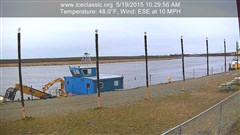
Open Hole on the east side of the River that BSAR & KSAR are working to mark
Today a BSAR team lead a group of travelers up to Kwethluk for a funeral, then they took a closer look at the section of the River between Bethel and Kwethluk. While the current trail described in our 12-4 post is safe, they found that there is still at least two open holes and a large area of only 3″ thick ice between the two communities. They also noticed that some travelers are not following the well used trail and just zooming down the smooth River assuming everything is safe.
There is one big long open hole along the east (north) bank across from and above the upper end of Church. BSAR and KSAR (Kwethluk) worked on marking this today with trees but only completed the east side and upper end of the hole before dark. We will work to finish the rest on 12-6.
The is another small open hole just around the bend downstream of Kwethluk along the east (north) bank of Kuskoquak Slough. This hole is marked.
In addition there is a large area of ice only 3″ thick below the Bethel Bluffs where an open hole that stretched across almost the entire River has just recently frozen over.
See map below for the approximate location of these open holes and thin ice areas:

Map of 12-5 Open Water & Thin Ice Areas Between Bethel & Kwethluk Shown in RED CIRCLES – safe trail is in YELLOW
BSAR will be working to mark the trail to Kwethluk on 12-6. Members and other volunteers that want to help can meet at the BSAR headquarters at 10 AM.
Thank you.


