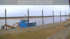
Bethel River Cam
Thank You Sponsors!
NOAA Weather
Bethel, AK
Last Updated on Jun 5 2024, 2:53 am AKDT
Weather by NOAA
Current Conditions: Overcast
Temp: 32°F
Wind: West at 5mph
Humidity: 85%
Windchill: 27°F
Weather Forecast
The location could not be found.Post History…
July 2025 M T W T F S S 1 2 3 4 5 6 7 8 9 10 11 12 13 14 15 16 17 18 19 20 21 22 23 24 25 26 27 28 29 30 31 Visit BSAR YouTube Channel!
Get Updates Automatically!
Bethel Search and Rescue
Welcome to our Website!
Bethel Search & Rescue (BSAR) is located in Bethel, Alaska.
BSAR conducts search and rescue missions in Bethel and the surrounding villages in coordination with the Alaska State Troopers, Bethel Police, Village Public Safety Officers, and other SAR teams from area villages.To report a missing person in the Bethel region, call 911 or (907)545-HELP.
File a Trip Plan BEFORE You Go!
Support…
Bethel Search and Rescue is a 501(c)(3) non-profit that operates on the support of the people and organizations in the Yukon-Kuskokwim Delta region and beyond. By supporting BSAR, supporters become partners in SAR missions. Each supporter should know that when a SAR mission is completed or successful, they have made it possible to find lost victims. Many thanks to all of our supporters, both individuals and businesses.
Contact Us:
Bethel Search and Rescue
P.O. Box 2633
Bethel, AK 99559Hosted By
Admin Users
Author Archives: admin
11.19.22 BSAR River Survey
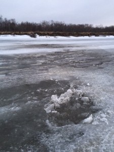
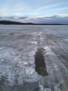
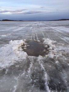
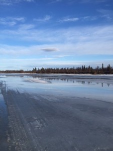
Summary: For the past several years BSAR has been scheduling our first aerial freeze up survey of the Kuskokwim River on November 18th. Flying the same day each year allows us to look back at previous years for comparison. In 2021, with a record cold November there were well established snow machine trails to nearby villages and even a limited amount of truck traffic on the River by this date. For November 18, 2022 conditions are very different. The lack of cold weather and early snowfall has slowed the freeze up process on the Kuskokwim River and it’s tributaries. THERE IS CURRENTLY TOO MUCH OPEN WATER ON THE KUSKOKWIM RIVER FOR SAFE TRAVEL
NO MAIN RIVER TRAVEL RECOMMENDED AT THIS TIME Due to the large number of open holes this report will only cover the ones in the immediate Bethel area. There are plenty! Some traditional areas of concern have actually frozen up better than previous years., but many other sections of the River have frozen up worse. We have pictures of the entire river from Kasigluk to Napaimute. Please let us know if there are specific areas you would like see.
CLICK HERE TO VIEW FULL 2022 REPORT WITH PICTURES:
11.19.21 BSAR River Survey
CLICK HERE TO VIEW FULL 2021 REPORT WITH PICTURES:
March 25 River Report – Bethel to Tuluksak
River Report Bethel to Tuluksak
Bethel Search and Rescue completed a river survey from Bethel to Tuluksak on March 25, 2015. The following observations were made:
Bethel:
Access getting on to the river has been by the Lomack building next to the seawall. Always be careful of the overflow water, there have been several instances where people have thought they could make it but the water was too deep. Please use caution when driving thru water!!
Bethel to Straight Slough:
There are a lot of pot holes to show up causing big sized holes on or by the truck trail.
Straight Slough to Kwethluk:
River trail is good. Church Slough trail is full of overflow and travel is not advised.
Kwethluk to Akiak :
The trail on the Kuskoquak is still good. There is standing water and some pot holes. The upper end of Kuskoquak to the bend below Akiak is the worst section for shell ice. Travelers to Akiak should use caution as the bend below Akiak has a lot of blown sand on the ice that is causing a lot of pot holes and many of them are getting big . Reports are that travelers are driving through the water that is reported to be about 30 to 36 inches deep- Please be careful.
With the warm weather we being having and the sand that is being blown it is causing the river ice to have many pot holes– use caution when traveling at night.
Akiak to Tuluksak:
There is standing water on top of the ice and cooler temperatures during the night is causing shell ice to form. Travelers in this section of the river are advised to use caution when driving.
BSAR members measured the ice in front of Bethel on the channel on Sunday, March 22, at 38 inches.
Travelers always have a travel plan and travel with caution.
Any questions on travel please call 545-4357 anytime.
- Straight Slough
- Straight Slough
- Bend Below Akiak
- Bend Below Akiak
- Near Tuluksak
- Above Tuluksak
- Above Tuluksak
- Above Tuluksak
From KYUK- BSAR Traveler Advisory
Bethel Search and Rescue is urging extra caution for travelers on the river due to deep overflow. The head of Bethel Search and Rescue, Mike Riley says there are multiple feet of overflow in many spots. Going upriver, Riley says Church slough is deep.
“It is very deep water and I would not recommend traveling that way at all. If you’re going to travel up rivers, stay on the main river please. Otherwise, from Bethel to Napakiak, there is a lot of overflow, and Napaskiak is reporting a lot of water on the entrance over there also,” said Riley.
Search and rescue is recommending travelers stay off the river at night. All of the normal entrances to the river at Bethel have very deep overflow. People have instead accessed it from inside of the boat harbor. Riley says south winds from the warm weather system have pushed water up the river.“The ice has dropped down, it makes it even deeper, you have to look at the ice itself,” said Riley.
11/20/2014 River Report
2:00pm 11/20/2014
Upper Kalskag reported water rising and at levels highest than any so far since this November break up started.


