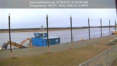
1-6-15 Slaaviq Ice Road Report:*

L-R Larry & Evon workinging to mark the truck trail in the Johnson River

L-R Larry & Evon working to mark the truck trail in the Johnson River

As of January 6th, conditions for truck travel in the Lower Kuskokwim are good. The River is smooth and with the recent cold days – the ice is thickening. There are well established truck trails from the Johnson River Villages to Tuluksak.

Truck trails have been marked from the Upper End of Church Slough to Akiachak and on up to Akiak and Tuluksak. From Bethel the truck trail is marked to Napaskiak and Napakiak. Below Napakiak there are no markers yet, but a crew is working to mark the road from Nunapitchuk and Kasigluk down the Johnson to the Kuskokwim. They were about halfway done as of the afternoon of January 6th.

Please beware that the weather is supposed to change over the next few days. It’s a good idea to call back Tundra to check their weather before heading down. Shell ice is still a problem on the beaches and bars so stay out on the River ice. Also, even though traveling by truck or car – dress warm, carry things to take care of your vehicle like shovel, oil, anti-freeze, spare tire, etc.

And please don’t let anyone drink and travel.

Safe Traveling & Happy Slaaviq from BSAR.

Thank you.

*Please note that this report is not an advisory that is safe to travel. It is for informational purposes only.


New Technology coming to Support Local Traditional Knowledge

High Resolution Side-Scanning Sonar is traveling over 3,000 miles to assist the recovery effort in Kuskoquak Slough

Actual Sonar Image of a Body Laying on the Bottom (Please Note: this image is not from the current search or any past search in our region)

High Resolution Side-scanning Sonar Equipment is Traveling Over 3,000 Miles to Assist with the Recovery Effort in Kuskoquak Slough

High Resolution Side-scanning Sonar Equipment is Traveling Over 3,000 Miles to Assist with the Recovery Effort in Kuskoquak Slough

Yesterday BSAR was contacted by Mr. Keith Cormican founder of Bruce’s Legacy, a Wisconsin-based non-profit organization that provides aid in locating drowning victims. Mr. Cormican has been following the the local recovery efforts on kusko.net/bsar/ and offered his services to our group. He was not requesting any compensation – only that we provide travel expense for himself and his equipment.

His equipment consists of sophisticated side-scanning sonar, which he has used extensively for under water body recovery along with under the ice recoveries.

Prior to speaking directly to Mr. Cormican, we thoroughly reviewed his website: BrucesLegacy.com

We later phoned him and talked at length about his experience and the characteristics of the recovery area that BSAR is currently working in. Based on the information exchanged in this conversation Mr. Cormican was optimistic that if the missing persons are on the bottom of the River, he can locate them with his equipment. His equipment can produce high resolution sonar images of the river bottom for one hundred feet on each side – for a total sweep of 200′ per pass. The River in this area is 800′ wide.

If they are frozen into the ice or suspended somewhere in the slush, his equipment will be less effective but maybe not entirely useless.

On Sunday evening at the daily BSAR debriefing our membership overwhelmingly approved the submission of a request for additional support for the travel expenses of Mr. Cormican to the Alaska State Troopers (AST).

We greatly appreciate the support AST has provided to date for this recovery effort, and felt that this additional support would not only improve the chances of a successful close to this case, but would also give BSAR the initial experience with this type of equipment, that will eventually lead to us toward obtaining and effectively operating our own side scanning sonar equipment for the benefit of recovery operations throughout the entire region.

With the ice is growing thicker each day, recovery efforts become more and more difficult. Due to this, time is of the essence. A written request for travel assistance for Mr. Cormican and his equipment was written that night and submitted to the Alaska State Troopers first thing this morning (December 22).

Our State Representative Bob Herron got wind of our request and followed up directly with the State Commissioner of Public Safety, Gary Folger. Mr. Folger  promptly approved the request.

This good news reached BSAR late this afternoon and we started the planning process for this new assistance immediately. Additional logistical and tactical details were discussed at length during tonight’s debriefing.

Mr. Cormigan will be arriving in Bethel from Wisconsin with his equipment Friday evening, December 26th. He will be brought to the recovery site on Saturday and will have three days to conduct his work.

Area of the Current Recovery Effort

Area of the Current Recovery Effort

In the meantime, recovery efforts will continue using the normal tried and true methods of our region’s People and their traditional knowledge.

Even after 10 days of cold, wet work our searchers are in good spirits and continue to work well together. If they aren’t successful in the coming days prior to Mr. Cormigan’s arrival, we will look forward to adding this new technology to support our local traditional knowledge.

A big thank you to all the searchers, supporters, Keith Cormigan, the Alaska State Troopers, Commissioner Folger, and Representative Herron.

Sonar Being Used in an Under-ice Recovery

Sonar Being Used in an Under-ice Recovery


Napaskiak Jr SAR Team Reaches Bethel!

Hardworking Napaskiak Jr SAR team has been working for several days marking the truck trail to Bethel

Hardworking Napaskiak Jr SAR team has been working for several days marking the truck trail to Bethel

The good young men have been going out each evening with their Ap’a Earl Samuelson learning how to keep winter travelers safe.

Napaskiak Jr SAR team is recognized at 12-22 BSAR meeting & rewarded with official BSAR jackets

Napaskiak Jr SAR team is recognized at 12-22 BSAR meeting & rewarded with official BSAR jackets

12-17-14 BSAR RIVER & TRAIL UPDATES:

While the focus of the last 5 days has been the recovery effort going in Kuskokuak Slough, a lot of other good work by SAR groups up and down the River has been going on. Here are a few of the reports coming in the last few days.

Napaskiak Junior Search & Rescue Members help mark the trail

Napaskiak Junior Search & Rescue Members help mark the trail from their village to Bethel

Akiak Search & Rescue has been working to mark the truck trail between their village and Akiachak.

Tuluksak Search & Rescue has marked the open holes between their village and Akiak. They will also be working to mark a truck trail between the two communities in the near future.

Further up the River:

Due to the ice jam below Kalskag there is no established trail between Tuluksak and Kalskag. An alternate overland route is being marked to connect the Lower River to Aniak. Due to the lack of snow this overland route is very rough (except on the lakes) but better than traveling through miles of broken, jumbled up ice chunks. This overland route is 60 miles long and takes about 5 hours to go across from end to end.

Marking a trail on Whitefish Lake as part of the overland route between Aniak and the Lower Kuskokwim

Marking a trail on Whitefish Lake as part of the overland route between Aniak and the Lower Kuskokwim

A trail on the River between Kalskag and Aniak has just recently been established. The few travelers that have used it report that it is very rough and that it takes 2-3 hours to get between the two communities. As this trail improves it will get marked by Kalskag Search & Rescue.

Above Aniak: there is no river trail above Aniak at this time. The 10 mile stretch between Aniak and Chuathbaluk is too rough for travel. Instead travel between the two communities is a combination of a short section of beach travel and then through the cat trail along the south bank that comes out right across from Chuathbaluk. The side-hilling beach trail can be avoided by using the Aniak River portage which is smoother but longer. These trails have been marked by Chuathbaluk Search & Rescue

Short section of beach trail between Aniak & Chuathbaluk - River too rough for travel

Short section of beach trail between Aniak & Chuathbaluk – River too rough for travel

Nice ride through the woods - the cat trail between Aniak and Chuathbaluk

Nice ride through the woods – the cat trail between Aniak and Chuathbaluk

The River crossing at Chuathbaluk marked with drums, stakes, and reflectors

The rough River crossing at Chuathbaluk marked with drums, stakes, and reflectors

There is no trail above Chuathbaluk at this time. These pictures show the reason why:

Huge mounds of ice from the November break up - this picture was taken 6 miles above Chuathbaluk

Huge mounds of ice from the November break up – this picture was taken 6 miles above Chuathbaluk

Beaches all along the Middle Kuskokwim are piled with ice chunks and riddled with shell ice

Beaches all along the Middle Kuskokwim are piled with ice chunks and riddled with shell ice

A very big thank you and good job to all the search and rescue groups along the Kuskokwim that have been working hard to keep our People safe in their winter travels.

Possible Tragedy on Kuskoquak Slough & Close Call Near Napakiak

The worst fears of Kuskokwim Search and Rescue Groups may have been realized today.

This morning, Akiak, Bethel, and Kwethluk SARs were notified of three overdue travelers between Bethel and Akiak. The people were all traveling on one four wheeler at night, in snowy weather. They were last seen late at night when they stopped at a permanently occupied camp above Kwethluk.

With air support from the Alaska State Troopers a set of ATV tracks were seen going into the lower end of an open hole in Kuskoquak Slough above the cutoff to the Little Kasigluk and Kiseralik Rivers.

This hole was marked but travel conditions were marginal at the time of the incident: dark & snowy, with flat smooth ice – a bad combination in an area that has open water. Earlier BSAR reports had recommended no general travel through this area.

Ground teams were able to confirm the tracks leading into the open water and a short time later recovered the four wheeler from beneath the newly formed ice. The four wheeler matched the description of the machine the missing travelers were using.

The area was carefully examined for signs that the driver and any potential passengers made it out of the water. No evidence was found.

It is believed that the person or persons are in the water. No names are being released at this time pending additional confirmation.

Recovery efforts will get underway tomorrow.

All area SAR groups are encouraged to contact the Kwethluk Public Safety Office for more information or to offer assistance.

This is the location of today's ATV recovery from an open hole. Additional recovery efforts will begin on 12/14

This is the location of today’s ATV recovery from an open hole. Additional recovery efforts will begin on 12/14

In Another Incident:

A person on a snowmachine traveling off-trail down the middle of the River below Napakiak drove into an open hole. We are thankful that the driver was able to make it out of the water, but the snowmachine was lost.

Search and Rescue teams are doing the best they can to mark open holes and warn people of the dangers that still exist out there. But the word is not getting out to everyone and there are others out there that think they know too much to listen to advice.

We are respectfully asking the People along the River to help get the word out so there are no further tragedies along the Kuskokwim this winter.

Thank you.

Open hole below Napakiak  where snowmachine was lost. Driver is OK. This hole just froze over last night.

Open hole below Napakiak where snowmachine was lost. Driver is OK. This hole just froze over last night.

WARNING! Danger area on the main river above Bethel – pictures taken 12-11 by Earl Samuelson, AST Pilot

Dangerous Area of Thin Ice & Open Water Between the Upper End of Schwabe Island and the Bethel Bluffs

Dangerous Area of Thin Ice & Open Water Between the Upper End of Schwabe Island and the Bethel Bluffs

With the nice cool weather we have been having the River has been freezing up nicely, but please do not assume that it is safe to travel everywhere or that every dangerous area has been marked. Stick to the trails that are used the heaviest and do not follow single sets of tracks. Look at the picture below:

Don't trust a single set of tracks - look where this person went. Someone following this track at a slower speed might not survive the trip.

Don’t trust a single set of tracks – look where this person went. Someone following this track at a slower speed might not survive the trip.