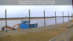
MAJOR DANGER IN STRAIGHT SLOUGH!*


Boat dragging for a snow machine that went into an open hole at the lower end of Straight Slough on December 1st.

CLOSE CALL CLOSE TO HOME: Boaters dragging for a snow machine that went into an open hole at the lower end of Straight Slough on December 1st. You can see Bethel in the background

Despite BSAR’s efforts to get the word out about the dangers of early season winter travel on the River, the word never reaches everyone and there’s some that don’t listen anyway.

On December 1st a snow machine with one adult and two children on board drove into the open hole at the lower end of Straight Slough.

We are very thankful that all three made it out of the water. The snow machine was lost.

BSAR will be working over the next few days to get this very dangerous area marked. Volunteers are needed.

Please help us get the word out: Travelers must avoid Straight Slough. Traffic above Bethel should use the trail around Joe Pete’s Bend to Church Slough.

Also with truck traffic opening up on the River, BSAR did some additional ice measuring along the route from Bethel to Napaskiak.

Ice thickness was consistently 10″ – 12″ thick. The top 2″ is snow ice which has less strength than good clear ice.

This thickness is considered marginal for trucks by experienced travelers. You can get away with it but please travel with extreme caution.

Sample of ice taken right on the truck trail by Nick O. Nick's old fish camp: this area was 11" thick minus 2" of snow ice = 9" of good ice

December 2 – Marginal Conditions for truck travel: Sample of ice taken right on the truck trail by Nick O. Nick’s old fish camp: this area was 11″ thick minus 2″ of snow ice = 9″ of good ice

That’s report.

Safe travels from BSAR

Thank you.

*Please note that this report is not an advisory that it is safe to travel. It is for informational purposes only.

50 Holes in 50 Miles: 11-24-15 BSAR Aerial River Survey*

Two open holes in front of Wassilie B. Evan's camp. There are 30 open holes in Kuskokwaq Slough alone

Two open holes in front of Wassilie B. Evan’s camp. There are 30 open holes in Kuskokwaq Slough alone

Summary: Today BSAR members flew with Earl Samuelson to survey 60 miles of the Kuskokwim from Napaskiak to Tuluksak. With warm temperatures, strong southerly winds, and rain stalling winter again the Lower Kuskokwim River is no place to be traveling right now.

Over 50 open holes were counted along 50 miles of the River. In addition the recent storm has brought deep overflow to all parts of the Lower River affected by the tide.

MAJOR DANGER: Open holes at the upper, middle, and lower end of Straight Slough

MAJOR DANGER: Open holes at the upper, middle, and lower end of Straight Slough. This is looking upsream from the lower end

The darkness of open water. These large open holes are formed when the flowing ice jams in a narrow channel upstream

The darkness of open water: These large open holes are formed when the flowing ice jams in a narrow or shallow channel upstream

The remainder of what was once a large hole. There are many of these smaller open areas scattered all throughout the River. A little cold weather will finish closing them up

SMALL BUT DEADLY: The remainder of what was once a large hole. There are many of these smaller open areas scattered all throughout the River. A little cold weather will finish closing them up

Looking downstream at the upper end of Kuskokwaq Slough. This open holes is just around the bend from where we lost 3 people in 2014 (yellow arrow)

Looking downstream at the upper end of Kuskokwaq Slough. This open hole is just around the bend from where we lost 3 people in 2014 (yellow arrow)

Closing: It was good to get up in the air with Earl again. We’ve missed working with him since he retired from the Alaska State Troopers last winter.

As you can see from these pictures no inter-village main river travel is recommended at this time. The glare ice with water on top makes it even harder to see the dozens of open water holes that are out there right now. A little cold weather will heal up the smaller ones then Kuskokwim SAR groups will start working on the bigger ones that will stay around for awhile.

Please be patient and if you must travel use the back trails.

And please don’t let anyone travel that has been drinking.

Thank you and Happy Thanksgiving from BSAR.

*This report is not an advisory that it is safe to travel. It is for informational purposes only.

11-22-15 Bethel Area Ice Report*

Sample of ice from mid-channel near the Crowley fuel dock

Sample of ice from mid-channel near the Crowley fuel dock

With cooler temperatures and fresh snow People are getting anxious to get started on their usual winter activities.

A BSAR team did an initial assessment of ice conditions in the immediate Bethel area today.

The area assessed was from the upper end of Oscarville Slough to the lower end of Church Slough. This is what they observed:

Ice thickness

Mid Channel straight out from the upper end of Oscarville Slough – 8″. There appears to be a well-traveled trail to Oscarville and Napaskiak using Oscarville Slough.

Bethel waterfront from Crowley to Brown Slough averaged 10″

The mouth of Straight Slough – 8″

10" of mostly good clear ice along the Bethel waterfront

10″ of mostly good clear ice along the Bethel waterfront

DANGER: STRAIGHT SLOUGH IS WIDE OPEN AT BOTH THE UPPER AND LOWER ENDS

Open water danger at the lower end of Straight Slough

Open water danger at the lower end of Straight Slough

Main River crossing to lower end of Church Slough – 8″ – No established trail through Church Slough at this time.

Additional Observations:

The safest and most heavily traveled routes from Bethel to the nearby villages is still by the back (overland) trails.

No open water is marked at this time and these dangerous areas are extremely hard to see in low light/low visibility.

As conditions improve Kuskokwim SAR trams will be working to mark the holes and established safe trails.

Additional updates will be provided as more information comes in. We hope to do an aerial survey before Thanksgiving.

Thank you & safe travels from BSAR

*Please note that this in not an advisory that it is safe to travel. It is for informational purposes only.

6-26 A New Role for BSAR: Assisting Upriver Communities with Fire Protection

A New Roles for BSAR: BSAR Hasty Team Delivers Fire Pumps to Upriver Communities: L- R Eric Pavil, Sam Samuelson, Norman Japhet, James Mute & Clarence Morgan

A New Role for BSAR: Hasty Team Delivers Fire Pumps to Upriver Communities: L- R Eric Pavil, Sam Samuelson, Norman Japhet, James Mute & Clarence Morgan

With wildfires threatening communities from Kalskag to Stony River and state firefighting resources stretched beyond capacity, BSAR responded to the call for additional fire fighting equipment by delivering four fire pumps and hundreds of feet of hose as far as Red Devil.

The BSAR hasty team made the 560 round trip from Bethel to Red Devil in less than 24 hours. They traveled through many miles of visibility less than 1/2 mile from the heavy smoke and areas where fire was actually burning right along the Riverbank.

These dedicated men traveled throughout the day and night stopping only for a short time in Red Devil to deliver the fire fighting equipment and eat. They finally took a short rest in Napaimute on the down bound trip early Friday morning.

Great work by a great crew.

The People Upriver wish to extend a big thanks to BSAR – especially Mike Riley, Earl Samuelson, Sam Samuelson, Norman Japhet, Clarence Morgan, Eric Pavil, and James Mute.

BSAR takes a quick look at the miles and miles of burned riverbank below Crooked Creek

BSAR takes a quick look at the miles and miles of burned riverbank below Crooked Creek


5-5 Evening Kuskokwim River Update:

The River Watch team flew this morning downriver to Napakiak  and  this
evening upriver to Chuathbaluk

Down river from Bethel, looks pretty clear between Napakiak and Napaskiak.
Johnson River is still not accessible by boat.

Up river from Bethel,  water at Aniak was up about two feet today from
yesterday. The Breakup
front has moved to just below Aniak today.  From Aniak to Kalskag continuing
to Coffee Bend  there is lots of original ice holding and
rotting in place.   Kalskag reports some shifting of ice in front of the
village today but the ice is not changed much.

Moving down River towards Bethel from the ice front there is lots of  stretches
of open water and  some ice
rotting in place. Tuluksak River still has ice and ice in the channel at the
mouth of the Tuluksak. Gweek River looks pretty clear. There is a new opening
in the ice at the “y” today that was not there yesterday. Tony Hall’s bend is
clear. Nelson Island channels are both plugged today with ice.  A little bit of
ice movement in front of Akiak today and water level there was reported to have
come up a little. Ice sill in place between Akiak and Akiachak.

Water levels remain low.

Wednesday  the River Watch team will fly to the ice front  near Aniak from
Bethel around
3:00pm

Ice Reports on KYUK and follow on twitter @ #akriverwatch
Or call/text RiverWatch cell 907-444-9517

5-3 Evening Kuskokwim River Update: Ice Yawns at Aniak & McGrath Area Ice Reaches Napaimute

Ice in Front of Aniak Slides Down Leaving a 100' Open Lead - courtesy Megan Leary

Ice in Front of Aniak Slides Down Leaving a 100′ Open Lead – courtesy Megan Leary

After days of rotting-in-place ice at Aniak, there was a little excitement this evening – but just for a short time. The main ice in front of town slid downstream a bit leaving a 100′ wide open lead. Then that was it – no other movement before dark.

Here was the water level at Aniak as of 1900 hrs:

picture courtesy of Megan Leary

picture courtesy of Megan Leary

The leading edge of the Upper Kuskokwim (McGrath area) ice reached Napaimute about 1800 hrs. There is some wood in this ice run but still far below normal. It looks like this ice and wood will catch up to the original ice still holding at Aniak and all come down with the rest of break up. Maybe some of the wood will get hung up when the ice at Aniak moves down and the water levels drop.

Water levels were rising at Napaimute and some of the ice stuck on the beach was floating off.  At the time of this report (2345) the River was about 40% full of ice.

2116 hrs Upper Kuskokwim Ice Filling Up the River at Napaimute Napaimute

2116 hrs Upper Kuskokwim Ice Filling Up the River at Napaimute

That’s the report for 5-3-15