4-28 Kuskokwim River at Sleetmute & Red Devil:


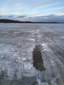
picture courtesy of Ruby Egrass

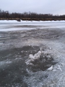
River at Red Devil – picture courtesy of Ruby Egrass

Other Reports from Upriver:

Stony River: ice moved for 1/2 an hour Sunday evening.

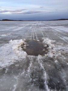
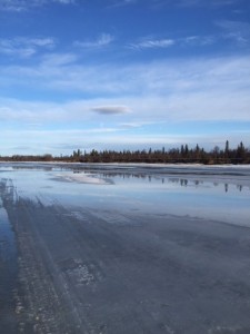
River of slush ice at Sleetmute - picture courtesy of Susan Hubbard

River of slush ice at Sleetmute – picture courtesy of Susan Hubbard

Susan Hubbard, Sleetmute: Here is what we look like just a few minutes ago. The main body of ice is slush and I’m guessing will pass in the next 12 hours. There is some open water on the sides, and one open section in front of the school. The water level has come up just to the bottom of the bank. Looks like it is going to be totally uneventful this year.

Barb Carlson, Sleetmute: Long leads in the middle of the river have opened from Sleetmute down to just above Midway.  These leads are generally where the river never froze or only froze for a short period near the end of Feb.  The leads continue to eat out and elongate during the heat of the day.  No pressure ridges visible from Midway.  Water is rising very slowly and is still quite low – most of our snow is gone except on north facing slopes.

Evelyn Thomas, Crooked Creek: We had some ice movement by the village and a crack opened up no pictures yet, it was last night around 8 p.m.

Eric Morgan, Chuathbaluk: Water slowly rising, but still very low. Water level about where it was when the River froze last fall.

Aniak: Aniak River wide open, and Aniak Slough open to the village. People are boating up the Aniak River.

Kalskag: no activity reported.

Nicolai Napoka, Tuluksak: Mouth of Tuluksak River bad. Main River channel right above the mouth has opened up. A little ice shifting in the short cut across from the Bogus Creek area reported by pilots.

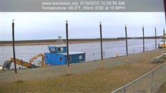
Deteriorating conditions in the Bethel area - picture courtesy of Early Samuelson, Sr.

Deteriorating conditions in the Bethel area – picture courtesy of Earl Samuelson, Sr.

4-10 BSAR River Report to the National Weather Service River Forecast Center

4-10 SUNRISE AT NAPAIMUTE: WATER FROM OPEN LEAD FLOODING ON TOP OF THE ICE

4-10 SUNRISE AT NAPAIMUTE: WATER FROM OPEN LEAD FLOODING ON TOP OF THE ICE

April 9 ice measurements:
Aniak – 42” middle of main channel just above town. 2” slushy fresh snow cover, first 12” are layers of frozen overflow from the various warm spells over the winter.
Napaimute – 35” mid channel. 2” slushy fresh snow cover. A long swift lead has opened up in the north channel just above Napaimute. You could watch it eating its way down stream. Just before sundown all of the fresh snow melting and running off must have caught up to the River. The water in the open lead began rising up over and flooding the top of the ice. We watched it growing throughout the night and had to warn some late night travelers away from the deepening water. See pictures.
Today a BSAR team went down and drilled the ice at the lower end of the November jam 11 miles below Lower Kalskag. We drilled at the narrowest point in the River below Coffee’s. This is where the November jam first began forming.
The ice in this spot was 58” thick. We couldn’t get through with an extension on the auger and ice picked the rest of the way. There is a layer of very dirty water about halfway through the ice in this area. Also the ice is full of sand, rocks, and sticks.
We’ve been wondering what’s going to happen if the interior temps keep warming up while it looks like the lower River weather is going to stay cool. There was a big difference in the weather today between Napaimute (warm & sunny) and Kalskag (cool & cloudy).
This area may be a place to watch closely this spring
Maybe good thing there’s not much snow.
Additional reports will be provided as the 2015 Kuskokwim Spring Break Up progresses.
Thank you.
4-9 OPEN LEAD AT NAPAIMUTE EATING ITS WAY DOWNSTREAM - THIS IS WHAT CAUSED THE FLOODING SHOWN IN THE FIRST PICTURE

4-9 OPEN LEAD AT NAPAIMUTE EATING ITS WAY DOWNSTREAM – THIS IS WHAT CAUSED THE FLOODING SHOWN IN THE FIRST PICTURE

3-30 Travel Advisory: No truck travel recommended on the Kuskokwim River

Teamwork: pulling a swamped vehicle out of the Kwethluk River

Teamwork: 6 mini-trucks work together to pull a swamped vehicle out of the Kwethluk River

Looks like it’s already time to stop using trucks and cars on the River and do our traveling by snow machine and ATV. Maybe even consider using the back trails – but with caution though because with the unseasonably warm temperatures warming up the land with no reflective snow there are additional dangers to travel even on land to be aware of such as deep puddles, opening up of creeks, and potholes in lake ice made by plants, muskrat push ups, etc.

It’s been a strange winter. First a November break up that prevented travel between the Lower and Middle River until mid-January. Then weeks and weeks of mild temperatures with very little cold or snow. Ice thicknesses have been good (38″ at Bethel on 3/22)considering how little real cold weather we’ve had – but they’re still several inches to a foot below normal. And the Bethel waterfront has been troublesome to traffic all winter long.

Now with another late March warm spell, lack of snow cover on the ice, sand, and the strong late winter sun, conditions have been deteriorating daily.

A second vehicle falls through the ice in the Middle of the Kwethluk River. A short time after this picture was taken the vehicle went completely under the water

A second vehicle falls through the ice in the middle of the Kwethluk River. A short time after this picture was taken the vehicle went completely under the water

The two bends below Akiak are full of water on top the ice from bank to bank. The sand blowing off the bars onto the ice has caused this area to melt extra hard on the warm sunny days we’ve had recently. The sand has also created potholes that grow deeper each day. BSAR did a river survey by snow machine through this area today. With the cooler temperatures overnight this overflow has a frozen layer then water underneath up to a foot or more deep. The new ice and light dusting of snow hide the potholes made by the sand but we found some of them to be 3 feet deep meaning that there is not very much original ice left at the bottom of these holes. Needle ice can be seen in many areas all along the River.

At this time there is no large vehicle traffic to Akiak – just a limited amount of snow machine travel. ATV travelers have to be extra careful as these machines don’t go over the half frozen water and potholes as easily or safely as a snow machine does.

ATV crashes after hitting a soft spot in the ice. The driver was pinned under the bike when he was found - but he was OK...lucky

ATV crashes after hitting a soft spot in the ice. The driver was pinned under the bike when he was found – but he was OK…lucky

We may see cooler temperatures over the next few days, and conditions may seem to improve, but this is deceiving. Winter is coming to an end – maybe close to a month earlier than we’re used to. A lot of damage has been done to the River over the past several days and with the strong sun, even on cold days winter will continue to release it’s grip on the River. And when it fully warms up again conditions will quickly deteriorate.

BSAR is advising no further truck or car travel on the River at this time. If you live in a village and want to keep your vehicle in Bethel for the summer, please get them here as soon as possible. Don’t wait until conditions get any worse…

remember this has been a strange winter and we still don’t know what’s going to happen. Let’s all try to be even more on the safe side as we go into spring.

Safe travels & happy spring from BSAR.

Thank you.

Bad Idea: trying to rescue swamped trucks on dangerous ice with a bull dozer that weighs 4 times more than a truck

Bad Idea: trying to rescue swamped trucks on dangerous ice with a bull dozer that weighs 4 times more than a truck


March 25 River Report – Bethel to Tuluksak

River Report Bethel to Tuluksak

Bethel Search and Rescue completed a river survey from Bethel to Tuluksak on March 25, 2015. The following observations were made:

Bethel:
Access getting on to the river has been by the Lomack building next to the seawall. Always be careful of the overflow water, there have been several instances where people have thought they could make it but the water was too deep.  Please use caution when driving thru water!!

Bethel to Straight Slough:
There are a lot of pot holes to show up causing big sized holes on or by the truck trail.

Straight Slough to Kwethluk:
River trail is good. Church Slough trail is full of overflow and travel is not advised.

Kwethluk to Akiak :
The trail on the Kuskoquak is still good. There is standing water and some pot holes. The upper end of Kuskoquak to the bend below Akiak is the worst section for shell ice.  Travelers to Akiak should use caution as the bend below Akiak has a lot of blown sand on the ice that is causing a lot of pot holes and many of them are getting big . Reports are that travelers are driving through the water that is reported to be about 30 to 36 inches deep- Please be careful.
With the warm weather we being having and the sand that is being blown it is causing the river ice to have many pot holes– use caution when traveling at night.

Akiak to  Tuluksak:
There is standing water on top of the ice and cooler temperatures during the night is causing shell ice to form. Travelers in this section of the river are advised to use caution when driving.

BSAR members measured the ice in front of Bethel on the channel on Sunday, March 22, at 38 inches.

Travelers always have a travel plan and travel with caution.

Any questions on travel please call 545-4357 anytime.

3-7 The Legendary AST Pilot Earl Samuelson, Sr. Honored at BSAR Community Gathering

Slide from the presentation given at today's gathering

Slide from the presentation given at today’s gathering

Another slide from the presentation showing a young Earl with his faithful plane 05H

Another slide from the presentation showing a younger Earl with his faithful plane 05H

Many People came from throughout the region and across the State to show their appreciation for Earl's long service to our People

Many People came from throughout the region and across the State to show their appreciation for Earl’s long service to our People

Earl is presented with a replica of the his plan: "05Hotel" - a plane and pilot known throughout the region

Earl is presented with a replica of the his plane: “05Hotel” – a plane and pilot known throughout the region

Alaska Department of Public Safety Commissioner Gary Folger presents Earl with awards for his service

Alaska Department of Public Safety Commissioner Gary Folger presents Earl with awards for his service

AWARD

Thank you to everyone that came out to show their appreciation to Earl Samuelson for his years of service to the People of Our Region.