Possible Tragedy on Kuskoquak Slough & Close Call Near Napakiak

Spread the word...Share on facebook
Facebook
Share on twitter
Twitter
Share on google
Google
Share on email
Email

The worst fears of Kuskokwim Search and Rescue Groups may have been realized today.

This morning, Akiak, Bethel, and Kwethluk SARs were notified of three overdue travelers between Bethel and Akiak. The people were all traveling on one four wheeler at night, in snowy weather. They were last seen late at night when they stopped at a permanently occupied camp above Kwethluk.

With air support from the Alaska State Troopers a set of ATV tracks were seen going into the lower end of an open hole in Kuskoquak Slough above the cutoff to the Little Kasigluk and Kiseralik Rivers.

This hole was marked but travel conditions were marginal at the time of the incident: dark & snowy, with flat smooth ice – a bad combination in an area that has open water. Earlier BSAR reports had recommended no general travel through this area.

Ground teams were able to confirm the tracks leading into the open water and a short time later recovered the four wheeler from beneath the newly formed ice. The four wheeler matched the description of the machine the missing travelers were using.

The area was carefully examined for signs that the driver and any potential passengers made it out of the water. No evidence was found.

It is believed that the person or persons are in the water. No names are being released at this time pending additional confirmation.

Recovery efforts will get underway tomorrow.

All area SAR groups are encouraged to contact the Kwethluk Public Safety Office for more information or to offer assistance.

This is the location of today's ATV recovery from an open hole. Additional recovery efforts will begin on 12/14

This is the location of today’s ATV recovery from an open hole. Additional recovery efforts will begin on 12/14

In Another Incident:

A person on a snowmachine traveling off-trail down the middle of the River below Napakiak drove into an open hole. We are thankful that the driver was able to make it out of the water, but the snowmachine was lost.

Search and Rescue teams are doing the best they can to mark open holes and warn people of the dangers that still exist out there. But the word is not getting out to everyone and there are others out there that think they know too much to listen to advice.

We are respectfully asking the People along the River to help get the word out so there are no further tragedies along the Kuskokwim this winter.

Thank you.

Open hole below Napakiak  where snowmachine was lost. Driver is OK. This hole just froze over last night.

Open hole below Napakiak where snowmachine was lost. Driver is OK. This hole just froze over last night.

WARNING! Danger area on the main river above Bethel – pictures taken 12-11 by Earl Samuelson, AST Pilot

Spread the word...Share on facebook
Facebook
Share on twitter
Twitter
Share on google
Google
Share on email
Email
Dangerous Area of Thin Ice & Open Water Between the Upper End of Schwabe Island and the Bethel Bluffs

Dangerous Area of Thin Ice & Open Water Between the Upper End of Schwabe Island and the Bethel Bluffs

With the nice cool weather we have been having the River has been freezing up nicely, but please do not assume that it is safe to travel everywhere or that every dangerous area has been marked. Stick to the trails that are used the heaviest and do not follow single sets of tracks. Look at the picture below:

Don't trust a single set of tracks - look where this person went. Someone following this track at a slower speed might not survive the trip.

Don’t trust a single set of tracks – look where this person went. Someone following this track at a slower speed might not survive the trip.

12-8 BSAR River Report*: a ground level look at the November ice jam at Coffee’s Bend

Spread the word...Share on facebook
Facebook
Share on twitter
Twitter
Share on google
Google
Share on email
Email
BSAR Members take an up close look at the Jam at Coffee's Bend - 10 miles below Kalskag

BSAR Members take an up close look at the Jam at Coffee’s Bend – 10 miles below Kalskag

On December 8th, a 3 man BSAR team traveled 90 miles upstream of Bethel by snowmachine to assess conditions for winter travel at the ice jam that occurred at Coffee’s Bend during the November break up of the Middle Kuskokwim.

They were only able to view the very lower end of the jam that extends several miles upstream. Earlier aerial reconnaissance showed that the worst section of this jam is about a mile further up.

This entire stretch of the Kuskokwim is impassable by motor vehicle at this time. Even walking through it is difficult.

The end of the line: from this point right at Coffee's old fish camp there is no more beach and the River is too rough to drive on

The end of the line: from this point right at Coffee’s old fish camp there is no more beach and the River is too rough to drive on

Broken pieces of ice are 4" - 12" thick

Broken pieces of ice are 4″ – 12″ thick

Ice is piled up to the top of the bank and into the willows

Ice is piled up to the top of the bank and into the willows

Broken ice in all kinds of thicknesses

Broken ice in all kinds of thicknesses

It will take a great deal of snow, wind and/or rain to improve this area enough for safe travel. Holiday travel from the Lower River to Kalskag may need to use the tundra, back sloughs, and old portages. One tough, brave person has already made the trip using these alternatives – taking two and a half days to go from Bethel to Kalskag. We will continue to monitor conditions in this area throughout the winter and into the spring to see how it affects the 2015 break up.

L-R: BSAR Members Manno Rodgers & Randy Turner make the long trip upriver to assess the jam at Coffee's Bend below Kalskag

L-R: BSAR Members Manno Rodgers & Randy Turner make the long trip from Bethel to assess the jam at Coffee’s Bend below Kalskag

Additional Observations Made on the Trip:

After two days of strong north winds – there is very little snow left out there. All River travel was on glare ice. The River around Akiak is sandy with blowing sand. The main trail to Akiak uses the Kuskokwim River from Akiachak. Kuskokquak Slough has two large open holes. One is marked – one is not. There is no main trail to Tuluksak on the River at this time. There is a very large unmarked open hole above Mike Napoka’s Island about halfway between Akiak and Tuluksak. Travel to Tuluksak is by back trail from either Akiachak or Akiak.

Above Tuluksak shell ice from last month’s high water is present on all the sandbars and beaches. This shell ice ranges from 1 to 2 feet or more deep.

Close up of the shell ice present all over on the beaches and bars above Tuluksak

Close up of the shell ice present all over on the beaches and bars above Tuluksak

This is how the shell ice above Tuluksak looks: white & puffy

This is how the shell ice above Tuluksak looks: white & puffy

While most of the small open holes above Tuluksak have frozen over there are still several large ones in 40 miles leading up to the jam at Coffee’s.

Large lip at the south end of an open hole at the upper end of Nelson Island above Tuluksak. This lip is over 2 feet tall from the strong north wind we've been having the past couple of days

Large lip at the south end of an open hole at the upper end of Nelson Island above Tuluksak. This lip is over 2 feet tall from the strong north wind we’ve been having the past couple of days

That’s the report for December 8, 2014

Thank you & safe travel from BSAR

*Please note: this report is for informational purposes only and is not an advisory that it is safe to travel


Kalskag High School Students Make Trail Markers out of Local Spruce as Class Fundraiser

Spread the word...Share on facebook
Facebook
Share on twitter
Twitter
Share on google
Google
Share on email
Email
Finished Bundles of Trail Markers (50 per bundle) made from local spruce

Finished Bundles of Trail Markers (50 per bundle) made from local spruce L-R: Reshelle Alexie, Sharla Parka, & Austin Hetherington


These students have already made and sold over 1,200 markers for Middle Kuskokwim trail marking this winter and are ready to make more!These students have already made and sold over 1,200 markers for Middle Kuskokwim trail marking this winter and are ready to make more!

Anyone needing trail markers is encouraged to contact mdammeyer@kuspuk.org or call 471-2288

Stapling reflectors on the locally made trail markers

Austin and Reshelle stapling reflectors on the locally made trail markers

12-6-14 Bethel – Kwethluk Trail Marked

Spread the word...Share on facebook
Facebook
Share on twitter
Twitter
Share on google
Google
Share on email
Email
trail markers used on Bethel - Kwethluk trail every 1/10 of mile or less apart

trail markers used on Bethel – Kwethluk trail every 1/10 of mile or less apart

This is the route BSAR marked on 12-6 between Bethel and Kwethluk

This is the route BSAR marked on 12-6 between Bethel and Kwethluk

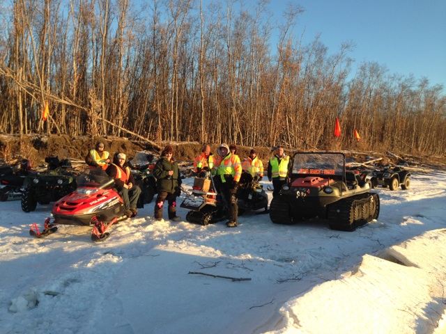
BSAR crew takes a coffee break with Kwethluk's main winter safety man: Elia Epchook (3rd from left)

BSAR crew takes a coffee break with Kwethluk’s main winter safety man: Elia Epchook (3rd from left)

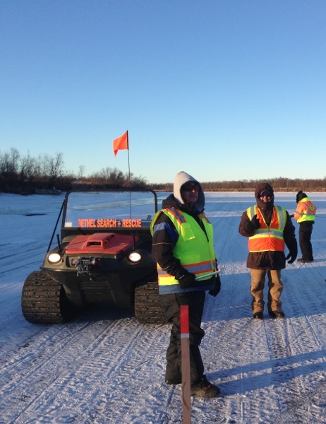
BSAR President Mike Riley leads crew. Members Hugh Ashepak & Jim Pete, Jr. in the background

BSAR President Mike Riley leads crew. Members Hugh Ashepak & Jim Pete, Jr. in the background

The BSAR crew heads home at the end of a good day on the River

The BSAR crew heads home at the end of a good day on the River

A hardworking crew of BSAR members marked the trail between Bethel and Kwethluk today. Markers are wooden stakes with white reflectors spaced 1/10 of a mile or less apart.

They also finished marking the recently frozen open water areas as the new ice over these holes is 3″ or less.

trees with blue reflectors are used to mark open water & thin ice areas

trees with blue reflectors are used to mark open water & thin ice areas

A small BSAR team made an advance recon trip through Kuskoquak Slough upstream of Kwethluk to its upper end where it meets the main Kuskokwim. This stretch of river is not recommended for general travel yet. There are still at least 3 open holes. One very large unmarked open hole is dangerously close to where the normal trail would be. The ice is very smooth and slippery. It would be hard for someone who gets off the trail to stop in time to avoid the deep, swift water.

BSAR member Nick Phillips points out the large open hole in Kuskoquak Slough above Kwethluk

BSAR member Nick Phillips points out the large open hole in Kuskoquak Slough above Kwethluk

A big thank you to all the BSAR members who helped out today with improving safe travel for the People along the River.


12-5-14 Warning: Open Holes in the Bethel – Kwethluk Area

Spread the word...Share on facebook
Facebook
Share on twitter
Twitter
Share on google
Google
Share on email
Email

Open Hole on the east side of the River that BSAR & KSAR are working to mark

12-5 Open Holes 004

Today a BSAR team lead a group of travelers up to Kwethluk for a funeral, then they took a closer look at the section of the River between Bethel and Kwethluk. While the current trail described in our 12-4 post is safe, they found that there is still at least two open holes and a large area of only 3″ thick ice between the two communities. They also noticed that some travelers are not following the well used trail and just zooming down the smooth River assuming everything is safe.

There is one big long open hole along the east (north) bank across from and above the upper end of Church. BSAR and KSAR (Kwethluk) worked on marking this today with trees but only completed the east side and upper end of the hole before dark. We will work to finish the rest on 12-6.

The is another small open hole just around the bend downstream of Kwethluk along the east (north) bank of Kuskoquak Slough. This hole is marked.

In addition there is a large area of ice only 3″ thick below the Bethel Bluffs where an open hole that stretched across almost the entire River has just recently frozen over.

See map below for the approximate location of these open holes and thin ice areas:

Map of 12-5 Open Water & Thin Ice Areas Between Bethel & Kwethluk

Map of 12-5 Open Water & Thin Ice Areas Between Bethel & Kwethluk Shown in RED CIRCLES – safe trail is in YELLOW

BSAR will be working to mark the trail to Kwethluk on 12-6. Members and other volunteers that want to help can meet at the BSAR headquarters at 10 AM.

Thank you.

BSAR member looks back at small open hole below Kwethluk

BSAR member looks back at small open hole below Kwethluk