Fifth day of tireless searching

20141216_144838

No new developments today……

About forty SAR members from different communities again converged upon the search site working 8-10 hours every day. Most members are volunteering their effort, transportation and taking personal time away from their jobs and families.

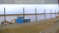
The weather has been in the mid 20’s with partly cloudy skies, making conditions perfect at the site. Although the lake has been freezing and slowly getting smaller. The lake has gained about 20 feet along the edge since the beginning of the search, creating dangerous thin ice conditions. The boat brought from Bethel by BSAR was used minimally as problems with the outboard hampered efforts. Hopefully the motor will be running tomorrow after it is thawed and serviced. The boat when up and running will be used to pull a drag bar with attached treble hooks along the river bottom near the edge of the open water. Meanwhile a crew on the ice will be pulling on a rope attached to the same drag bar from a trench cut into the ice.

Today searchers were getting wet having to use waterproof foot gear including bunny boots and rubber gloves when dragging and poling.

20141217_151047

Underwater camera used by BSAR. As the camera is lowered into the hole in the ice, searchers view the screen and watch as layers of ice and slush slip past. After checking immediately under the ice, the camera is lowered about 26 feet to the bottom where a view of the riverbed is checked.

20141217_151020

The 7 inch LCD displays in black and white and is split into four separate views as the camera has four separate lenses. The camera apparatus has small LED lights illuminating an area about 3-4 feet in diameter immediately above the lens.

20141217_155125

The views are dependent upon lighting and the amount of debris in the water. We are hoping for brighter underwater lighting in the future along with color displays.

For 12-18-14, the search will continue with volunteers coming from nearby communities. As previously requested, VPSO Sgt. Max Olick with Kwethluk SAR is asking for donations, including food to assist in the search.

12-17-14 BSAR RIVER & TRAIL UPDATES:

While the focus of the last 5 days has been the recovery effort going in Kuskokuak Slough, a lot of other good work by SAR groups up and down the River has been going on. Here are a few of the reports coming in the last few days.

Napaskiak Junior Search & Rescue Members help mark the trail

Napaskiak Junior Search & Rescue Members help mark the trail from their village to Bethel

Akiak Search & Rescue has been working to mark the truck trail between their village and Akiachak.

Tuluksak Search & Rescue has marked the open holes between their village and Akiak. They will also be working to mark a truck trail between the two communities in the near future.

Further up the River:

Due to the ice jam below Kalskag there is no established trail between Tuluksak and Kalskag. An alternate overland route is being marked to connect the Lower River to Aniak. Due to the lack of snow this overland route is very rough (except on the lakes) but better than traveling through miles of broken, jumbled up ice chunks. This overland route is 60 miles long and takes about 5 hours to go across from end to end.

Marking a trail on Whitefish Lake as part of the overland route between Aniak and the Lower Kuskokwim

Marking a trail on Whitefish Lake as part of the overland route between Aniak and the Lower Kuskokwim

A trail on the River between Kalskag and Aniak has just recently been established. The few travelers that have used it report that it is very rough and that it takes 2-3 hours to get between the two communities. As this trail improves it will get marked by Kalskag Search & Rescue.

Above Aniak: there is no river trail above Aniak at this time. The 10 mile stretch between Aniak and Chuathbaluk is too rough for travel. Instead travel between the two communities is a combination of a short section of beach travel and then through the cat trail along the south bank that comes out right across from Chuathbaluk. The side-hilling beach trail can be avoided by using the Aniak River portage which is smoother but longer. These trails have been marked by Chuathbaluk Search & Rescue

Short section of beach trail between Aniak & Chuathbaluk - River too rough for travel

Short section of beach trail between Aniak & Chuathbaluk – River too rough for travel

Nice ride through the woods - the cat trail between Aniak and Chuathbaluk

Nice ride through the woods – the cat trail between Aniak and Chuathbaluk

The River crossing at Chuathbaluk marked with drums, stakes, and reflectors

The rough River crossing at Chuathbaluk marked with drums, stakes, and reflectors

There is no trail above Chuathbaluk at this time. These pictures show the reason why:

Huge mounds of ice from the November break up - this picture was taken 6 miles above Chuathbaluk

Huge mounds of ice from the November break up – this picture was taken 6 miles above Chuathbaluk

Beaches all along the Middle Kuskokwim are piled with ice chunks and riddled with shell ice

Beaches all along the Middle Kuskokwim are piled with ice chunks and riddled with shell ice

A very big thank you and good job to all the search and rescue groups along the Kuskokwim that have been working hard to keep our People safe in their winter travels.