4-29 Kuskokwim River Pictures Bethel – Napaimute:

Josh Kameroff warms up while watching the 2015 Kuskokwim Break Up at Napaimute

Josh Kameroff warms up while watching the 2015 Kuskokwim Break Up at Napaimute

Schwabe Island area - notice how dark the ice is on main channel side and below

Schwabe Island area – notice how dark the ice is on main channel side and below

Gweek River area - bad ice

Gweek River area – bad ice

Tuluksak Area

Tuluksak Area

Ice free Aniak River & Slough

Ice free Aniak River & Slough

Shifting ice behind the cross - River wide open for several miles above.

Shifting ice behind the cross – River wide open for several miles above.

How it looks from River level - water low but rising

How it looks from River level – water low but rising


4-29 River Pictures:

Ice Moves out at Sleetmute - courtesy Susan Hubbard

Ice Moves out at Sleetmute – courtesy Susan Hubbard

Susan reports: “The main channel of ice in front of Sleetmute moved out last evening. It didn’t go far as you can see in the 3rd photo. It has stopped just at the end of the village. There is still a shelf of ice upriver from my place and a long stretch reading up from the island across from the village. The last picture shows the extent of the shore ice… next to nothing. I’ll keep everyone posted as things continue through out today.”

Aniak last night - courtesy Megan Leary

Aniak last night – courtesy Megan Leary

River at Upper Kalskag - courtesy NVKLG Environmental Department

River at Upper Kalskag – courtesy NVKLG Environmental Department

4-29 Report from Stony River (no pictures):

Kevin Gusty reports this morning:

“Our River and sloughs are melting and water has been low but we have alot of open water everywhere. Lots of birds and a black bear once in a while.

The Ice was not very thick this year and from what I could gather it is the same up River, the ice shifts almost every day ,not much to tell but like I said it is just mostly melting and shifting little by little and when the ice goes it will go all out. I dont think we or anyone will have flood issues this year – if there are issues I would be surprised.”

4-28 Kuskokwim River at Sleetmute & Red Devil:


picture courtesy of Ruby Egrass

River at Red Devil – picture courtesy of Ruby Egrass

Other Reports from Upriver:

Stony River: ice moved for 1/2 an hour Sunday evening.

River of slush ice at Sleetmute - picture courtesy of Susan Hubbard

River of slush ice at Sleetmute – picture courtesy of Susan Hubbard

Susan Hubbard, Sleetmute: Here is what we look like just a few minutes ago. The main body of ice is slush and I’m guessing will pass in the next 12 hours. There is some open water on the sides, and one open section in front of the school. The water level has come up just to the bottom of the bank. Looks like it is going to be totally uneventful this year.

Barb Carlson, Sleetmute: Long leads in the middle of the river have opened from Sleetmute down to just above Midway.  These leads are generally where the river never froze or only froze for a short period near the end of Feb.  The leads continue to eat out and elongate during the heat of the day.  No pressure ridges visible from Midway.  Water is rising very slowly and is still quite low – most of our snow is gone except on north facing slopes.

Evelyn Thomas, Crooked Creek: We had some ice movement by the village and a crack opened up no pictures yet, it was last night around 8 p.m.

Eric Morgan, Chuathbaluk: Water slowly rising, but still very low. Water level about where it was when the River froze last fall.

Aniak: Aniak River wide open, and Aniak Slough open to the village. People are boating up the Aniak River.

Kalskag: no activity reported.

Nicolai Napoka, Tuluksak: Mouth of Tuluksak River bad. Main River channel right above the mouth has opened up. A little ice shifting in the short cut across from the Bogus Creek area reported by pilots.

Deteriorating conditions in the Bethel area - picture courtesy of Early Samuelson, Sr.

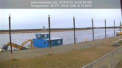
Deteriorating conditions in the Bethel area – picture courtesy of Earl Samuelson, Sr.

4-10 BSAR River Report to the National Weather Service River Forecast Center

4-10 SUNRISE AT NAPAIMUTE: WATER FROM OPEN LEAD FLOODING ON TOP OF THE ICE

4-10 SUNRISE AT NAPAIMUTE: WATER FROM OPEN LEAD FLOODING ON TOP OF THE ICE

April 9 ice measurements:
Aniak – 42” middle of main channel just above town. 2” slushy fresh snow cover, first 12” are layers of frozen overflow from the various warm spells over the winter.
Napaimute – 35” mid channel. 2” slushy fresh snow cover. A long swift lead has opened up in the north channel just above Napaimute. You could watch it eating its way down stream. Just before sundown all of the fresh snow melting and running off must have caught up to the River. The water in the open lead began rising up over and flooding the top of the ice. We watched it growing throughout the night and had to warn some late night travelers away from the deepening water. See pictures.
Today a BSAR team went down and drilled the ice at the lower end of the November jam 11 miles below Lower Kalskag. We drilled at the narrowest point in the River below Coffee’s. This is where the November jam first began forming.
The ice in this spot was 58” thick. We couldn’t get through with an extension on the auger and ice picked the rest of the way. There is a layer of very dirty water about halfway through the ice in this area. Also the ice is full of sand, rocks, and sticks.
We’ve been wondering what’s going to happen if the interior temps keep warming up while it looks like the lower River weather is going to stay cool. There was a big difference in the weather today between Napaimute (warm & sunny) and Kalskag (cool & cloudy).
This area may be a place to watch closely this spring
Maybe good thing there’s not much snow.
Additional reports will be provided as the 2015 Kuskokwim Spring Break Up progresses.
Thank you.
4-9 OPEN LEAD AT NAPAIMUTE EATING ITS WAY DOWNSTREAM - THIS IS WHAT CAUSED THE FLOODING SHOWN IN THE FIRST PICTURE

4-9 OPEN LEAD AT NAPAIMUTE EATING ITS WAY DOWNSTREAM – THIS IS WHAT CAUSED THE FLOODING SHOWN IN THE FIRST PICTURE